Burghwallis
Part 1
Introduction
This is the second part of the Carcroft and District Local History website, based on a set of 12 display panels found recently.
For the first part and more information about the Society, use this link.
See also, this website about Burghwallis.
Contents
1086 Domesday Book
Old Maps
St Helen's Church
The War Memorial
Lords of the Manor of Burghwallis
The Village Pump
The 19thc. Well
Burghwallis Hall
The Roman Forts
C&D LHS webmaster: Jack Bayes
1086 Domesday Book
Burg
Manor. In Burg, Toc has three carucutes of land for geld, and three ploughs may be there. Now William has (it) of Ilbert. In the desmesne one plough, and three villanes and three bordars having two ploughs and a half, and two acres of meadow. Wood, pasturabvle, hald a leuga in length and as much in breadth. The whole manor, one leuga in length and half (a leuga) in breadth. T.R.E., it was worth forty shillings; now, thirty shillings.
Land of Ilbert de Laci.
Old Maps
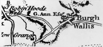
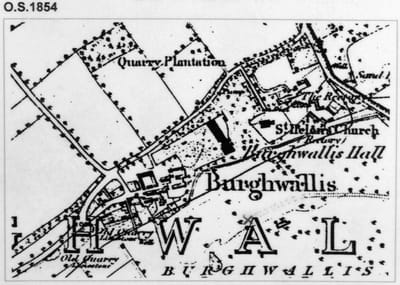
Between 1802 and 1809, Michael Ann, Lord of the Manor, constructed a new road at the North side of the village.
By the time of the Enclosure Award in 1815, some of the old cottages near the Hall had been demolished and new ones built to the West, so determining the present day layout of the village.
St. Helen's Church
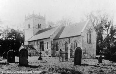
The early church consisted of nave, chancel and possibly an earlier tower; the present tower is of 12th Century design, in three stages; the embattlements with gargoyles and pinnacles are 15th Century. The East end of the chancel was extended early 15thC. and the East window dates to this period. The oak Rood screen is late mediaeval, donated to the church by William Adam; he is buried a few feet away from it.
Much restoration was done during the late 19thC. The Chancel arch was restored, the Jacobean pulpit and reading desk were removed and carved oak ones put in their place. Rooves of both Nave and Chancel were replaced, the pitches being raised and the Chancel roof being changed from flat to oak barrel. The East window was raised so that it was above the new alabaster reredos.
Further restoration was done in the 1930's; the pre-reformation stone altar slab was found buried and restored to it's proper place. A stone pulpit replaced the wooden one and panels from this were used in the present choir gallery.
The War memorial
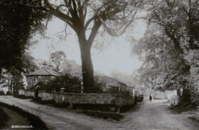
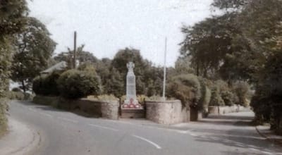
The war memorial was erected in 1923 at the entrance to the village where once stood a bench.
A runic cross in Portland stone, it is inscribed with the names of those ten men of the village who gave their lives in two world wars.
A runic cross in Portland stone, it is inscribed with the names of those ten men of the village who gave their lives in two world wars.
Lords of the Manor of Burghwallis
By 1412, the manor had passed, (again by marriage), into the hands of Sir William Gasgoine, High Sherriff of Yorkshire, whose family estate was at Garthorpe near Leeds. Sherds of green-glazed pottery found on the site of the early manor house date from the 14thC., suggesting that it may have been abandoned soon after this time.
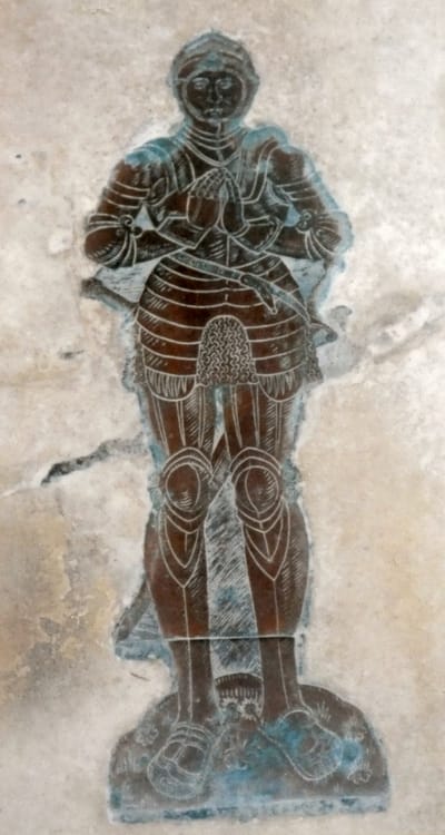
Thomas Gasgoine, a younger brother of a later Sir William, appears to have lived at Burghwallis. He died in 1554; the brass on his grave, showing him dressed in a suit of armour, can be seen in the church.
During the reign of Elizabeth I, the manor passed into the ownership of the Anne family and remained with them for 400 years. In the early years, their main residence was at Frickley and the Hall at Burgwallis was used as a Dower house or as the residence of the eldest son. The Anne's sold the Burghwallis estate in 1941.
The Village Pump & the old Plague Well
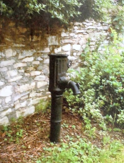
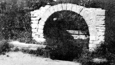
Although no longer providing water, it is still standing on Pump Lane, carefully preserved.
The old Plague Well (lower left) was situated on a stream that runs in front of the Dower House on Abbes Walk, the running water constantly refreshing the well. Nothing now remains, although the base and filled in well were still visible in the 1950's.
It was known as the 'Plague Well' and the stone roofing and seats were probably in existence at the time of the great plague of 1665. At that time it would have been the main well for the village, which was situated just up the hill around the church.
Outbreaks of plague were a scourge of mediaeval England and one way of retaining them was for villagers to wash and cleanse the coinage in running water and leave it in the well in exchange for produce and goods left by tradesmen.
The 19th Century Well
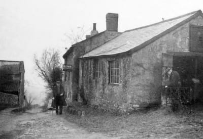
A new well was sunk when the village was rebuilt to the West of the Church in the early 19thC.
This was over and underground stream that provided another shallow ell in the adjacent Pinfold.
During WWII, the village post office was situated in a cottage on Well Lane, run by the village smith, Mr Scurrah; (on the left hand picture), he can be seen at work on a wrought iron gate. The gentleman walking up the lane is thought to be Mr. Seaman.
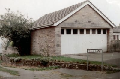
On the other picture (right) is the present view of Well Lane, with the workshop replaced by a garage and the cottage by a modern house.
Burghwallis Hall
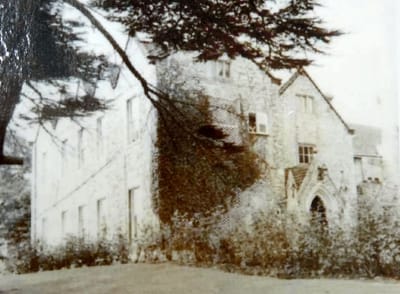
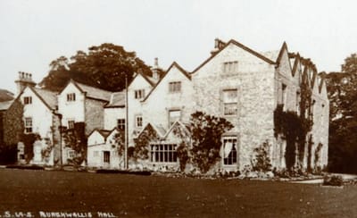
The hall probably remained as a Tudor building for many years after it passed to the Anne family about 1690. During the 18thC., a five bay South-West wing with a centre three bay rood pediment was built and exterior rendered with stucco. Michael Anne inherited the estate in 1802; after his marriage in 1810 he sold the family estate at Bodney in Norfolk, using some of the proceeds to enlarge and alter the Hall at Burghwallis. Stucco was removed and the central pediment on the South-West wing dismantled to all for a further story with five gables.
In 1941, the Hall was sold to the Bishop of Leeds. The Anne family had always been of the Catholic faith and in 1946, tradition carried on as the Hall passed to the 'Sisters of Charity of Our Lady of Good and Perpetual Succour'. They turned the Hall into a rest home for elderly ladies. In 1986, it was sold to the Dominican Sisters of Oakford, a South African Foundation. They made extensive alterations, building a new Chapel and a retreat room, although the Hall continues to be a Rest Home for elderly ladies.
The Roman Forts
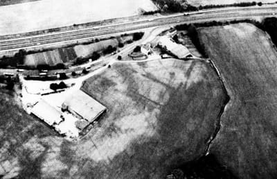
This aerial photograph, (Derek Riley 1970s), shows the two stages of Roman forts built at the side of the original Roman road to the North, (now the A1).
This was most likely still a prominent feature in the landscape when the Domesday Survey was taken in 1086 and so led to the parish being called 'Burg'.
This was most likely still a prominent feature in the landscape when the Domesday Survey was taken in 1086 and so led to the parish being called 'Burg'.
